Spatial Optimization of Mega-City Fire Stations Based on Multi-Source Geospatial Data: A Case Study in Beijing

摘要
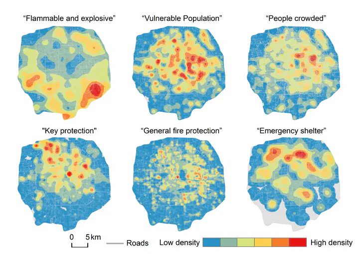
The spatial distribution of fire stations is an important component of both urban development and urban safety. For expanding mega-cities, land-use and building function are subject to frequent changes, hence a complete picture of risk profiles is likely to be lacking. Challenges for prevention can be overwhelming for city managers and emergency responders. In this context, we use points of interest (POI) data and multi-time traffic situation (MTS) data to investigate the actual coverage of fire stations in central Beijing under different traffic situations. A method for identifying fire risks of mega cities and optimizing the spatial distribution of fire stations was proposed. First, fire risks associated with distinctive building and land-use functions and their spatial distribution were evaluated using POI data and kernel density analysis. Furthermore, based on the MTS data, a multi-scenario road network was constructed. The “location-allocation” (L-A) model and network analysis were used to map the spatial coverage of the fire stations in the study area, optimized by combining different targets (e.g., coverage of high fire risk areas, important fire risk types). Results show that the top 10% of Beijing’s fire risk areas are concentrated in “Sanlitun-Guomao”, “Ditan-Nanluogu-Wangfujing”, and “Shuangjing-Panjiayuan”, as well as at Beijing Railway Station. Under a quarterly average traffic situation, existing fire stations within the study area exhibit good overall POI coverage (96.51%) within a five-minute response time. However, the coverage in the northwest and southwest, etc. (e.g., Shijicheng and Minzhuang) remain insufficient. On weekdays and weekends, the coverage of fire stations in the morning and evening rush hours fluctuates. Considering the factors of high fire risk areas, major fire risk types, etc. the results of optimization show that 15 additional fire stations are needed to provide sufficient coverage. The methods and results of this research have positive significance for future urban safety planning of mega-cities.